
There will be traffic restrictions in place this weekend in Dublin City Centre, around Parnell Square. An Garda Siochana have assured the Hospital that patients will be provided access to the hospital as in the past.
Staff and visitors will be able to get to the hospital by being aware of the road closures and the routes to circumvent them.
Staff can show their hospital ID to Gardai if required to gain access to the Hospital.
Below is a map of the parade route, and info from Dublin City Council about the specific road closures.
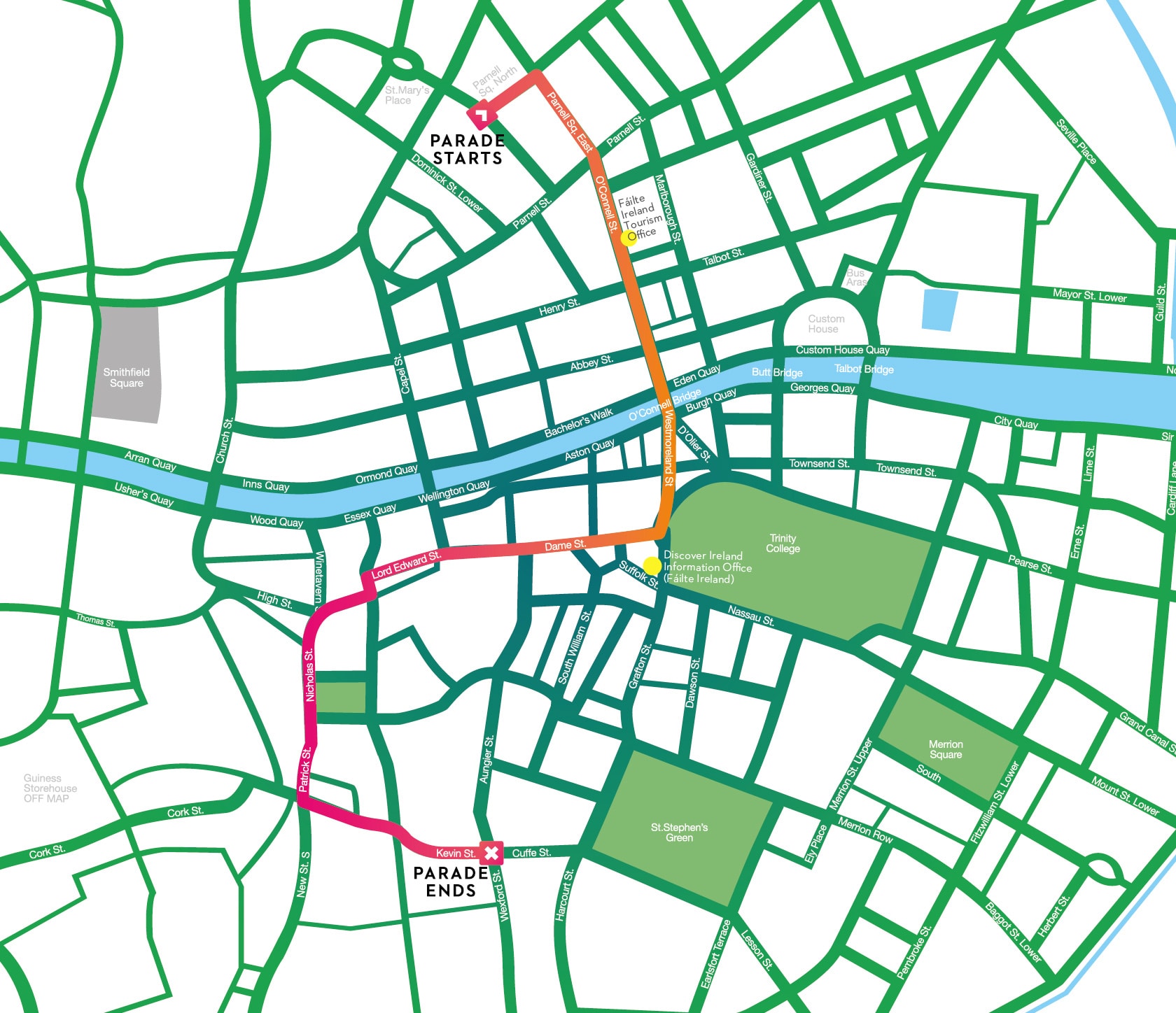
St. Patrick’s Day Parade Traffic Restrictions
Location A:
- Western Way from 19.00hrs on Saturday 16th March 2019 to 15.00hrs on Sunday 17th March 2019.
Location B:
- Mountjoy Street, Mountjoy Street Middle, Palmerstown Place, Wellington Street, Street Mary’s Place North,
- Granby Row, Parnell Square North, Parnell Square East, Cavendish Row, O’Connell Street Upper & Lower,
- O’Connell Bridge, Westmoreland Street, College Green, Dame Street, Lord Edward Street,
- Christchurch Place Nicholas Street, Patrick Street, New Street South, Clanbrassil Street Lower,
- Kevin Street Upper, Kevin Street Lower, Cuffe Street and St Stephens Green South
- from 04.30hrs to 18.00hrs on Sunday 17th March 2019.
Traffic Management Plan
- Traffic on Arran Quay travelling north and east will be diverted via Church St, Constitution Hill, North Circular Rd, Portland Row and Amiens Street.
- Traffic on North Wall Quay travelling south will be diverted via City Quay Lombard Street, Westland Row, Merrion Square North, Mount Street Lower
- Traffic on North Wall Quay travelling west will be diverted via George’s Quay Beresford Place, Gardiner Street, North Circular Road, Infirmary Road, Parkgate Street.
- Pedestrian access will be maintained.
More information on Traffic Restrictions from Dublin City Council